Click for more products.
No produts were found.
Click for more products.
No produts were found.
Welcome

Massif de l'Esterel relief map - Pays de Fayence 3DMap

Discover the Massif de l'Esterel - Pays de Fayence region

TheMassif de l'Esterel - Pays de Fayence relief map is produced by the French 3DMap brand. It presents this fabulous region in precise detail. The map provides a wealth of useful information for hiking, sightseeing, paragliding and many other activities.

Dimensions (cm): 41 x 61

Planimetric scale: 1:90,000

Height scale: 1: 50,000

Possibility of adding a frame.

Read moreShow less
€39.90 (tax incl.)
On order
Close
Reference:
4033
Description

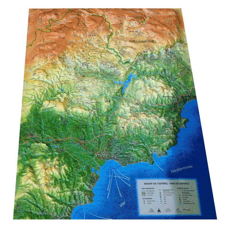
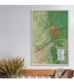
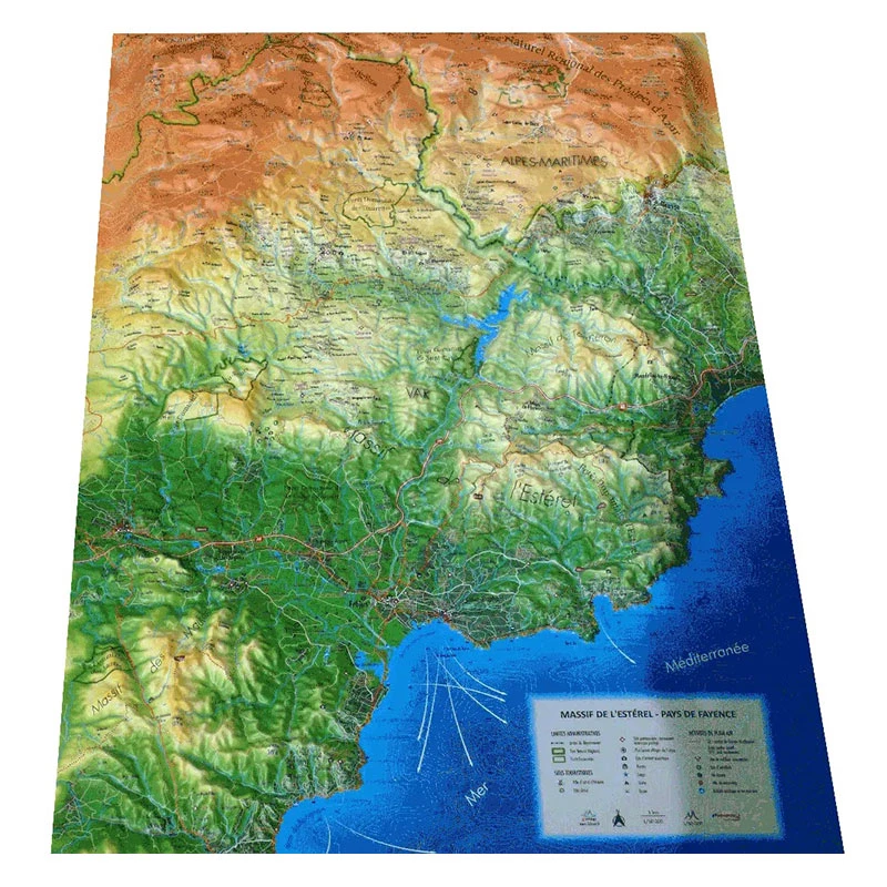
Le Massif de l'Esterel - Pays de Fayence: the perfect relief map!

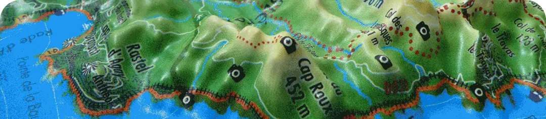
Explore the Massif de l'Esterel - Pays de Fayence region in the best possible way with this 3DMap relief map, and discover the enchanting mountains and reliefs of this magnificent geographical area from a whole new angle. View also other information such as paragliding sites, ski resorts or Via Ferrata sites.

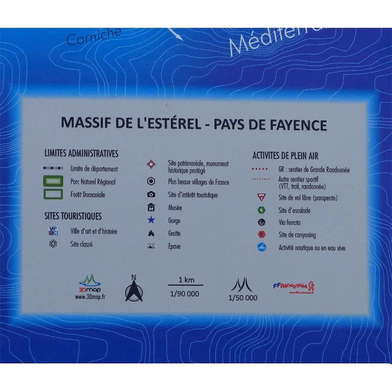
Other information presented:

  • UNESCO World Heritage sites
  • Most beautiful villages in France
  • Cultural heritage
  • Museums
  • Religious heritage
  • Natural sites
  • Waterfalls
  • Prehistoric sites
  • Caves
  • Belvederes, orientation tables
  • Long-distance hiking trails
  • Refuges
  • Alpine and Nordic ski resorts
  • Via Ferrata
  • Golf courses
  • White-water activities
  • Paragliding sites (www.ffvl.fr)
  • Take-offs, Landings
  • Airports, Aerodromes

3D MAP 3DMAP: A 100% FRENCH BRAND

In 2016, 3Dmap was launched by a sibling group with a passion for geography. The brand offers relief cartography to enhance regions. Thanks to an innovative approach and advanced technologies, 3Dmap transforms geographic information into detailed maps, including underwater relief, with remarkable precision and quality.

3DMap brand maps offer a print quality far superior to that of older relief maps. This is the result of extensive R&D efforts and French design.

For a better presentation, complete your 3D map with a suitableframe (available in 4 colors).

And don't forget thatAir et Aventure also offers many other 3DMap relief maps . Don't hesitate to discover them!

Read moreShow less
Product Details
4033

Data sheet

Type of map
Map
TYPE OF PRODUCTS
RELIEF MAP
Related products
€39.90 (tax incl.)
Map of Physical France This relief map shows the physical France in relief. The quality of the printing makes it easy to spot the mountains of the different regions and the ideal places to take off or land a...
In stock, immediate delivery!
€39.90 (tax incl.)
Map of the Alpes Provençales This relief map features the Alpes de Haute Provence. Thanks to the quality of its design, you'll be able to easily locate the region's mountains and the ideal places to take off or land a...
In stock, immediate delivery!
€35.90 (tax incl.)
A frame to enhance your relief map This stylish wooden frame is ideal for 3DMap embossed maps. Color: White / Black / Wood / Ash Dimensions (cm): 43 x 63 Width (mm) : 15 Thickness (mm) : 30
In stock, immediate delivery!
€24.00 (tax incl.)
Vol-rando in France: topo-guide to the most beautiful flights Discover the most beautiful vol-randos in France. From the Corsican coast to the magnificent mountain pastures of Haute-Savoie, via the dormant volcanoes...
In stock, immediate delivery!

Settings

Menu