Click for more products.
No produts were found.
Click for more products.
No produts were found.
Welcome

Relief map Parc du Pilat - Monts du Lyonnais 3DMap

A precise, practical and fun relief map

The relief map of the Pilat et monts lyonnais park shows you this region from the air. Thanks to its 3D relief, you'll be able to easily find the region's mountain ranges, as well as the best paragliding spots around Lyon.

Dimensions (cm): 41 x 61

Planimetric scale: 1/175,000

Altimeter scale: 1/55,000

Possibility of adding a frame

Read moreShow less
€39.90 (tax incl.)
On order
Close
Reference:
3998
Description

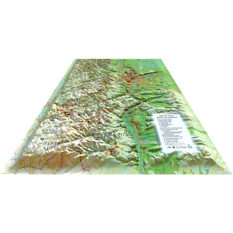
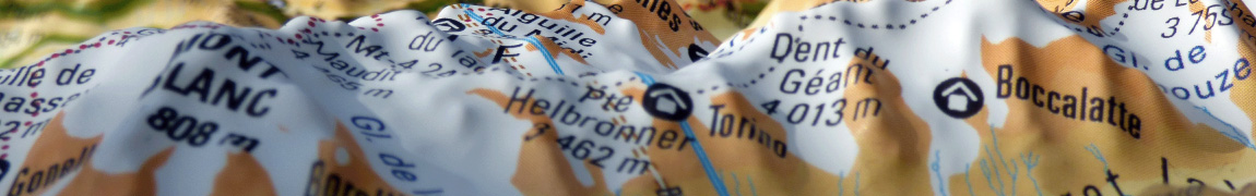
One of the most comprehensive 3D maps on the market

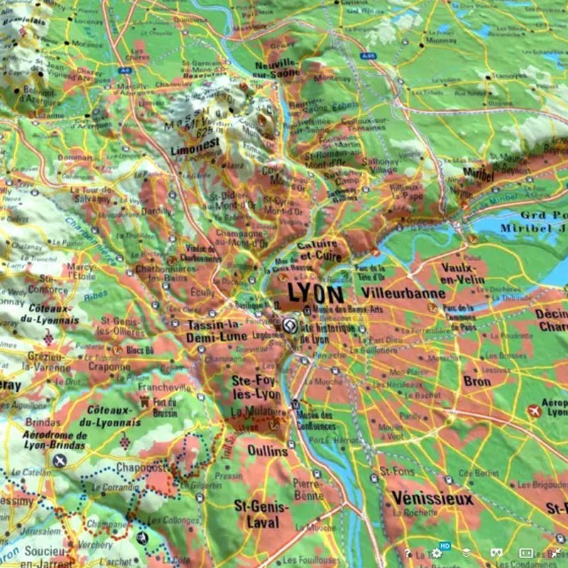
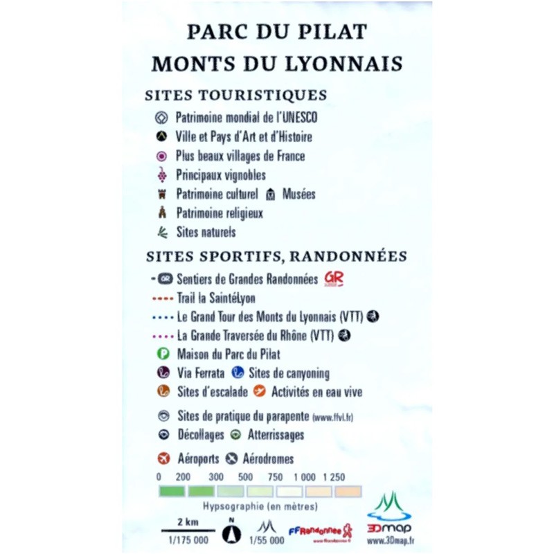
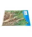
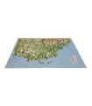
This relief map presents the Pilat Park and the Monts du Lyonnais. From the route of the famous SaintéLyon trail to the grand traversée du Rhône and the grand tour des monts du lyonnais, this map will guide you through this beautiful region. You'll find paragliding sites, observatories, France's most beautiful villages and much more:

  • Natural sites
  • Glaciers and peaks
  • Spa resorts
  • Ski resorts
  • Natural sites
  • Via Ferrata sites
  • Refuges
  • Museums
  • Golf courses
  • Beaches
  • Airfields
  • Monuments and castles of legend
  • Religious sites
  • Hiking trails
  • Trails
  • White water activities
  • Remarkable itineraries
  • Orienteering tables
  • Hydrological, natural and hypsometric data
  • Administrative data

3D Map: French relief maps

3DMap brand maps mark a new departure in the world of cartography. They are the fruit of major R&D efforts, and offer exceptional quality. Created by two brothers from the Vaucluse region of France with a passion for geography, 3DMap maps are designed to showcase the cultural, sporting and tourist attractions of French regions.

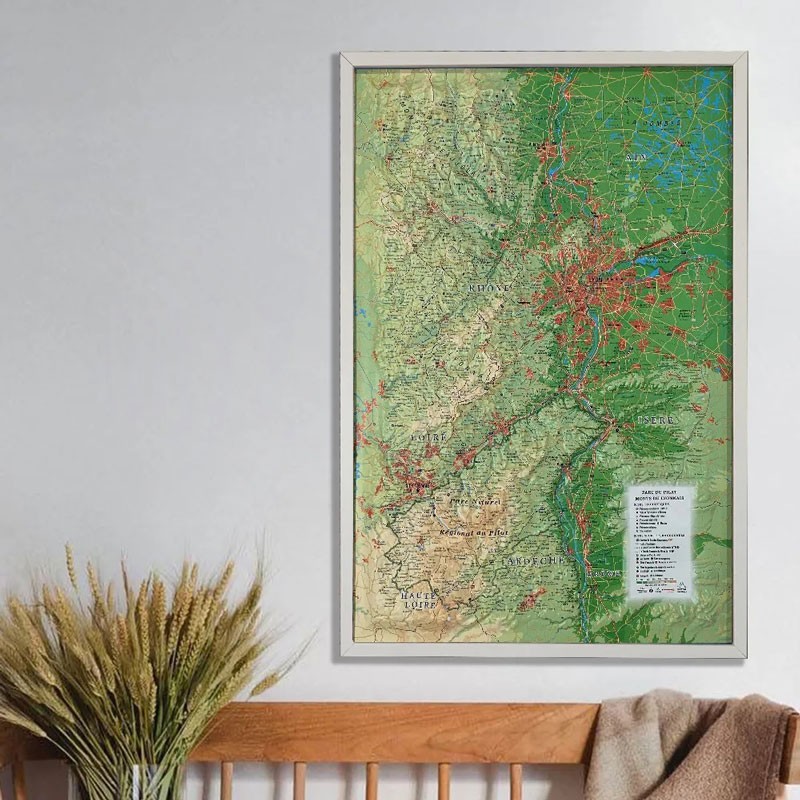
Last but not least, you can add a frame to your relief map ( available in 4 colors) for a more attractive presentation.

Please note thatAir et Aventure also offers many other 3D maps from 3DMap. Don't hesitate to discover them!


Bannière de la carte en relief du Tour du Mont Blanc
Read moreShow less
Product Details
3998

Data sheet

Type of map
Mini map
TYPE OF PRODUCTS
RELIEF MAP
BF Types
Relief maps
Related products
€35.00 (tax incl.)
The bottle to take everywhere The bottle features a magnetic mechanical locking system. It can be attached to any supporting equipment. Neo's shorty harness features a Fidlock bottle holder. Capacity (ml): 600 Color :...
In stock, immediate delivery!
€24.00 (tax incl.)
Vol-rando in France: topo-guide to the most beautiful flights Discover the most beautiful vol-randos in France. From the Corsican coast to the magnificent mountain pastures of Haute-Savoie, via the dormant volcanoes...
In stock, immediate delivery!
€28.00 (tax incl.)
Cold doesn't have to get in the way of great adventures Wherever you go, the new Niviuk bonnet is ideal for protecting you from low temperatures.Technical Details Materials: 100% acrylicColors: Reversible : dark gray...
On order
€39.90 (tax incl.)
Map of France's most beautiful mountains This relief map features the Hautes Alpes region. Thanks to the quality of its design, you'll be able to easily locate the region's mountains and the ideal places to take off...
In stock, immediate delivery!

Settings

Menu