Click for more products.
No produts were found.
Click for more products.
No produts were found.
Welcome

3DMap Jura and Léman Relief Map

Jura and Lake Geneva map

This relief map shows the Jura mountains and Lake Geneva in relief. The quality of the printing makes it easy to identify the mountains of the various regions and the ideal places for paragliding take-offs and landings, as well as a wealth of other useful information.

Dimensions (cm): 41 x 61

Planimetric scale :1/195 00

Altimeter scale: 1/120 000

Possibility of adding a frame

Read moreShow less
€39.90 (tax incl.)
In stock, immediate delivery!
Close
Reference:
4067
Description

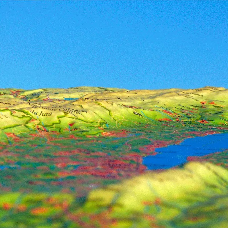
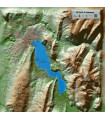
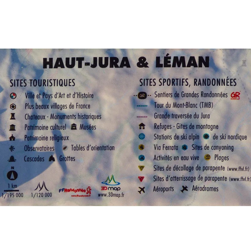
Discover the landforms on either side of the Jura and Léman rivers

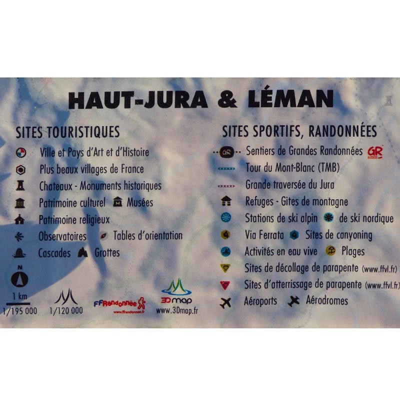
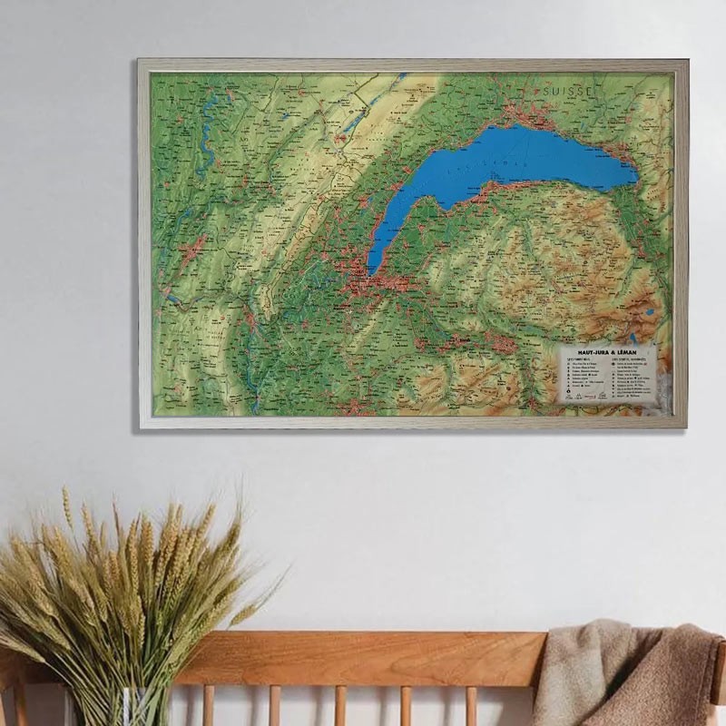
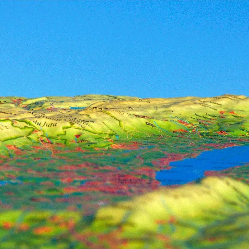
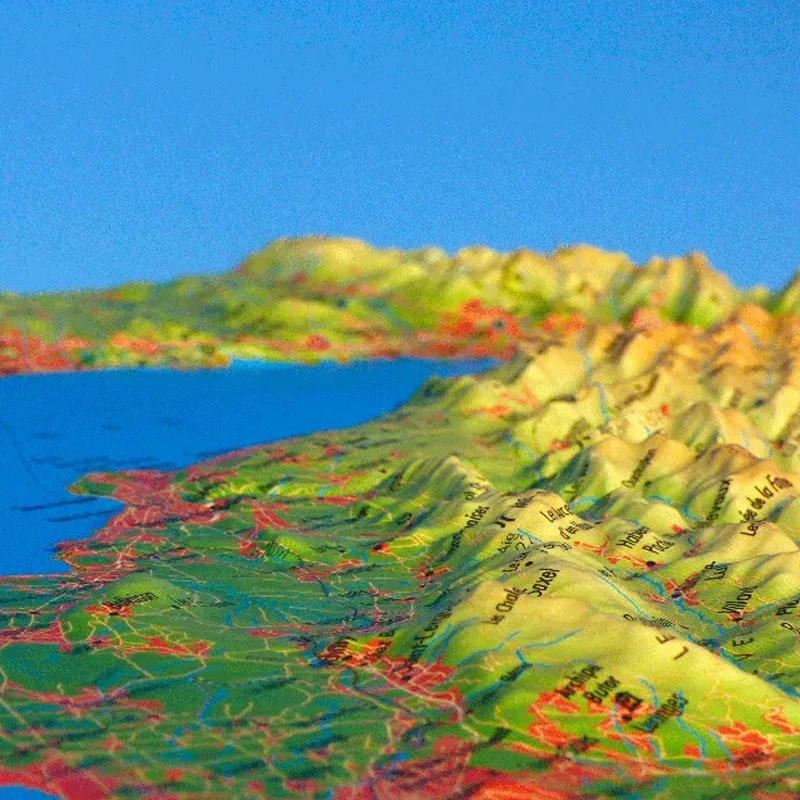
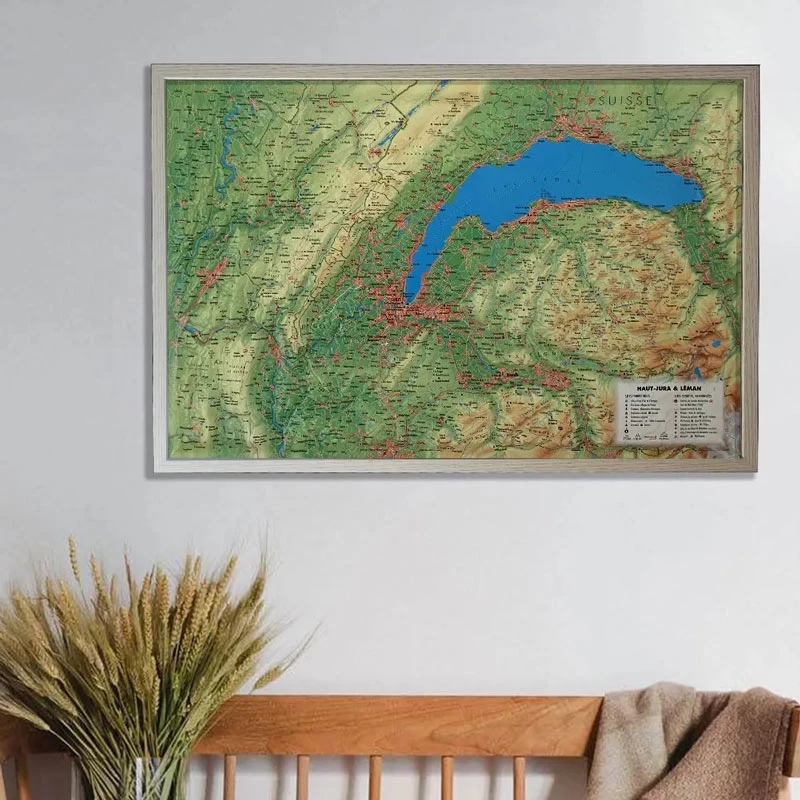
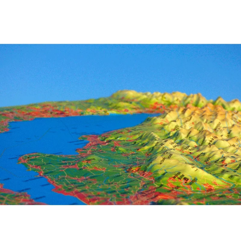
Decorate your living room with the Jura and Léman relief map. Discover the sumptuous mountains and valleys of this region from the Jura to Lake Geneva via Chablais , the Jura Vaudois Park and the Bernese Alps. View hydrological, natural and hypsometric data, administrative data and national borders. You can also take advantage of the various national parks and UNESCO natural heritage sites. You'll also find all the canyoning sites, golf courses, spas and ski resorts, as well as paragliding sites and long-distance hiking trails. Last but not least, take advantage of the relief map of the Mont-Blanc Massif and the surrounding region, featuring rivers, glaciers, lakes, prehistoric sites, caves and waterfalls.

100% FRENCH MANUFACTURING :

3DMap brand maps offer printing quality far superior to that of older relief maps. This is the fruit of major R&D efforts and French design.

In addition, 3D processing software has been specifically developed to enable wider use of geographic information, such as bathymetric data.

For a better presentation, complete your relief map with a suitableframe (available in 4 colors).

And don't forget thatAir et Aventure also offers many other 3D maps from 3DMap. Don't hesitate to discover them!

Read moreShow less
Product Details
4067

Data sheet

Type of map
Map
TYPE OF PRODUCTS
RELIEF MAP
BF Types
Relief maps
Customers who bought this product also bought:
€39.90 (tax incl.)
Map of Physical France This relief map shows the physical France in relief. The quality of the printing makes it easy to spot the mountains of the different regions and the ideal places to take off or land a...
In stock, immediate delivery!
Limited special offer
€110.00 (tax incl.) €125.00
Supair's PILOT is a helmet that knows how to be forgotten! Excellent field of vision Ventilation provided by internal air circuit Adjustable chinstrap buckle with rack and pinion fastener With adjustment wheel Size...
In stock, immediate delivery!
€35.90 (tax incl.)
A frame to enhance your relief map This stylish wooden frame is ideal for 3DMap embossed maps. Color: White / Black / Wood / Ash Dimensions (cm): 43 x 63 Width (mm) : 15 Thickness (mm) : 30
In stock, immediate delivery!
Related products
€35.90 (tax incl.)
A frame to enhance your relief map This stylish wooden frame is ideal for 3DMap embossed maps. Color: White / Black / Wood / Ash Dimensions (cm): 43 x 63 Width (mm) : 15 Thickness (mm) : 30
In stock, immediate delivery!
€24.00 (tax incl.)
Vol-rando in France: topo-guide to the most beautiful flights Discover the most beautiful vol-randos in France. From the Corsican coast to the magnificent mountain pastures of Haute-Savoie, via the dormant volcanoes...
In stock, immediate delivery!
€39.90 (tax incl.)
Relief map for recreational and educational use Discover the sumptuous Ecrins massif in a whole new way with this 3DMap relief map. This uniquely precise map shows the region's massifs, important paragliding take-off...
In stock, immediate delivery!
€39.90 (tax incl.)
Map of France's most beautiful mountains This relief map features the Hautes Alpes region. Thanks to the quality of its design, you'll be able to easily locate the region's mountains and the ideal places to take off...
In stock, immediate delivery!

Settings

Menu