Click for more products.
No produts were found.
Click for more products.
No produts were found.
Welcome

3DMap Alpine Arc Relief Map

Map of the Alpine Arc

This relief map shows the Alpine Arc in relief. The quality of the printing makes it easy to identify the mountains of the different regions and the ideal places for paragliding take-offs and landings, as well as a wealth of other useful information.

Dimensions (cm) : 41 x 61

Planimetric scale :1/1 700 000

Height scale: 1/150,000

Possibility of adding a frame

Read moreShow less
€39.90 (tax incl.)
In stock, immediate delivery!
Close
Reference:
4065
Description

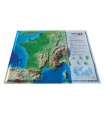
Discover the reliefs on either side of the Alpine Arc

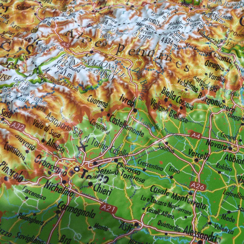
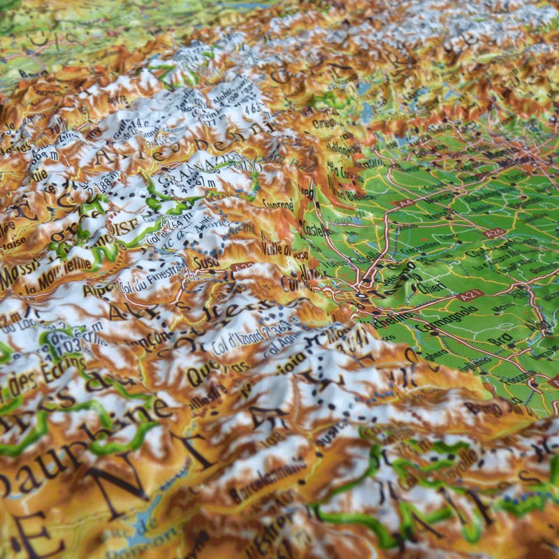
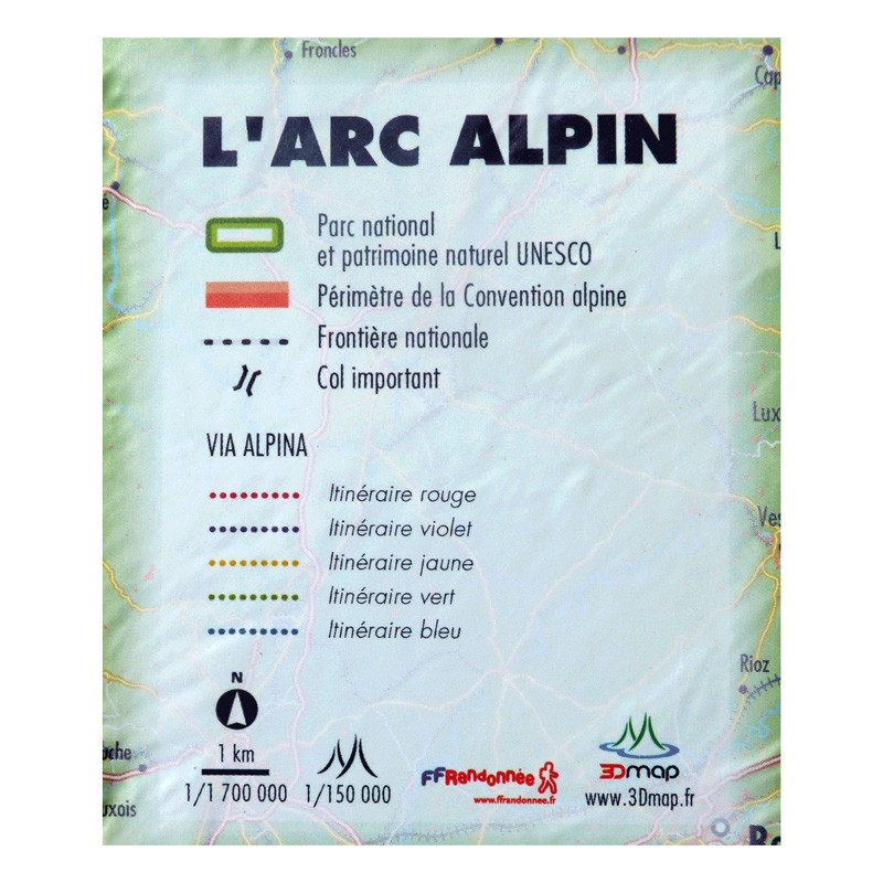
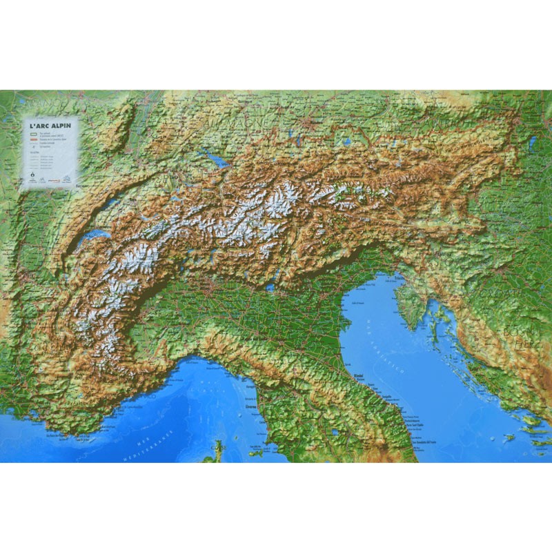
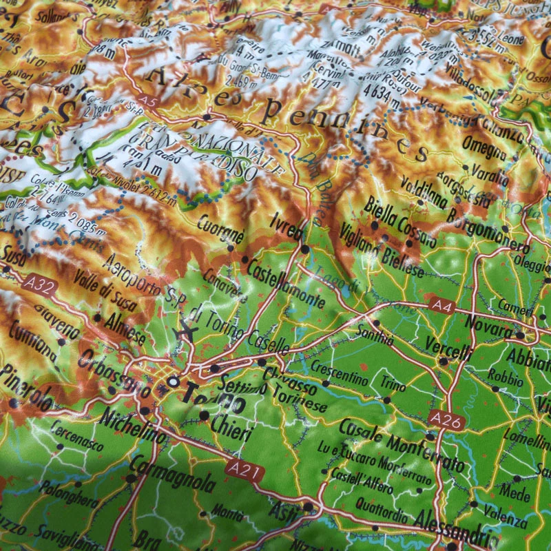
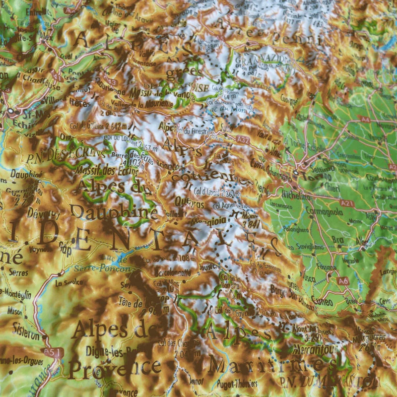
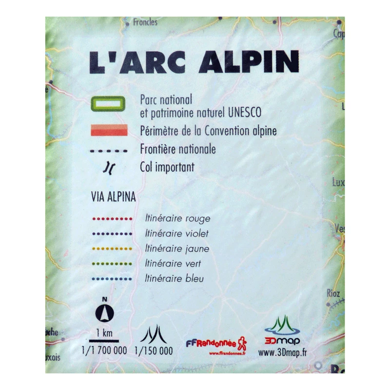
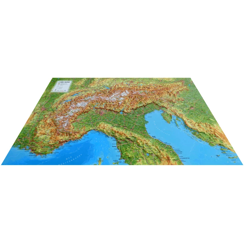
Decorate your living room with a relief map of theAlpine Arc. Discover the sumptuous mountains and valleys on either side of the French, Italian, Austrian, Swiss and German Alps. View hydrological, natural and hypsometric data, administrative data and national borders. You can also take advantage of the various national parks and UNESCO natural heritage sites. When it comes to sports and hiking, you'll be able to see the perimeter of the Alpine Convention, all the major passes such as the Col Agnel, the Col du grand St Bernard and the South Tyrol passes. Discover the Via Alpina and its different routes: red, purple, yellow, green and blue. Finally, take advantage of the relief map of theAlpine Arc to discover the different rivers, glaciers and lakes.

100% FRENCH MANUFACTURING :

3DMap brand maps offer printing quality far superior to that of older relief maps. This is the fruit of major R&D efforts and French design.

In addition, 3D processing software has been specifically developed to enable wider use of geographic information, such as bathymetric data.

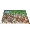
For a better presentation, complete your relief map with a suitableframe (available in 4 colors).

And don't forget thatAir et Aventure also offers many other 3D maps from 3DMap. Don't hesitate to discover them!

Read moreShow less
Product Details
4065

Data sheet

Type of map
Map
TYPE OF PRODUCTS
RELIEF MAP
BF Types
Relief maps
Customers who bought this product also bought:
€35.90 (tax incl.)
A frame to enhance your relief map This stylish wooden frame is ideal for 3DMap embossed maps. Color: White / Black / Wood / Ash Dimensions (cm): 43 x 63 Width (mm) : 15 Thickness (mm) : 30
In stock, immediate delivery!
€39.90 (tax incl.)
A HIGHLY ACCURATE 3DMAP RELIEF MAP Discover the Queyras Ubaye region in a whole new way with this 3D Map. This hard-to-reach region is a hiker's paradise. The 3DMAP map offers unique precision, so you'll easily find...
In stock, immediate delivery!
€39.90 (tax incl.)
A precise and practical relief map The Sainte Baume - Sainte Victoire relief map shows you this region from the air. Thanks to its 3D relief, you'll be able to easily locate the region's mountain ranges and...
In stock, immediate delivery!
Related products
€35.90 (tax incl.)
A frame to enhance your relief map This stylish wooden frame is ideal for 3DMap embossed maps. Color: White / Black / Wood / Ash Dimensions (cm): 43 x 63 Width (mm) : 15 Thickness (mm) : 30
In stock, immediate delivery!
€24.00 (tax incl.)
Vol-rando in France: topo-guide to the most beautiful flights Discover the most beautiful vol-randos in France. From the Corsican coast to the magnificent mountain pastures of Haute-Savoie, via the dormant volcanoes...
In stock, immediate delivery!
€39.90 (tax incl.)
Relief map for recreational and educational use Discover the sumptuous Ecrins massif in a whole new way with this 3DMap relief map. This uniquely precise map shows the region's massifs, important paragliding take-off...
In stock, immediate delivery!
€39.90 (tax incl.)
Map of France's most beautiful mountains This relief map features the Hautes Alpes region. Thanks to the quality of its design, you'll be able to easily locate the region's mountains and the ideal places to take off...
In stock, immediate delivery!

Settings

Menu