Click for more products.
No produts were found.
Click for more products.
No produts were found.
Welcome

3DMap French Alps and Alpine Massifs Relief Map

Visit the Alps from the comfort of your own home

This relief map features the French Alps. Thanks to the quality of its design, you'll be able to easily locate the region's mountains and the ideal places to take off or land a paraglider, as well as a host of other useful information.

Dimensions (cm) : 41 x 61

Scale : 1/660 000

Possibility of adding a frame

Read moreShow less
€39.90 (tax incl.)
In stock, immediate delivery!
Close
Reference:
2989
Description

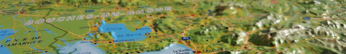
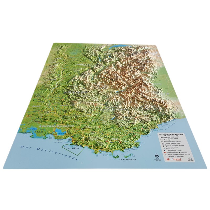
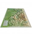
Compare your routes with the French Alps relief map

Use the French Alps reliefmap to find your favorite flying spots across the Alps. From Marseille to Geneva, rediscover the sumptuous massifs of the south-east. You'll find all the famous sites of the Rhône Valley. You can also view paragliding sites, ski resorts, Via Ferrata sites and many other sporting and cultural attractions:
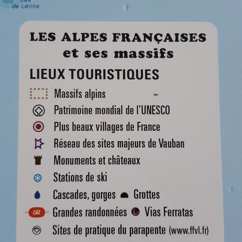
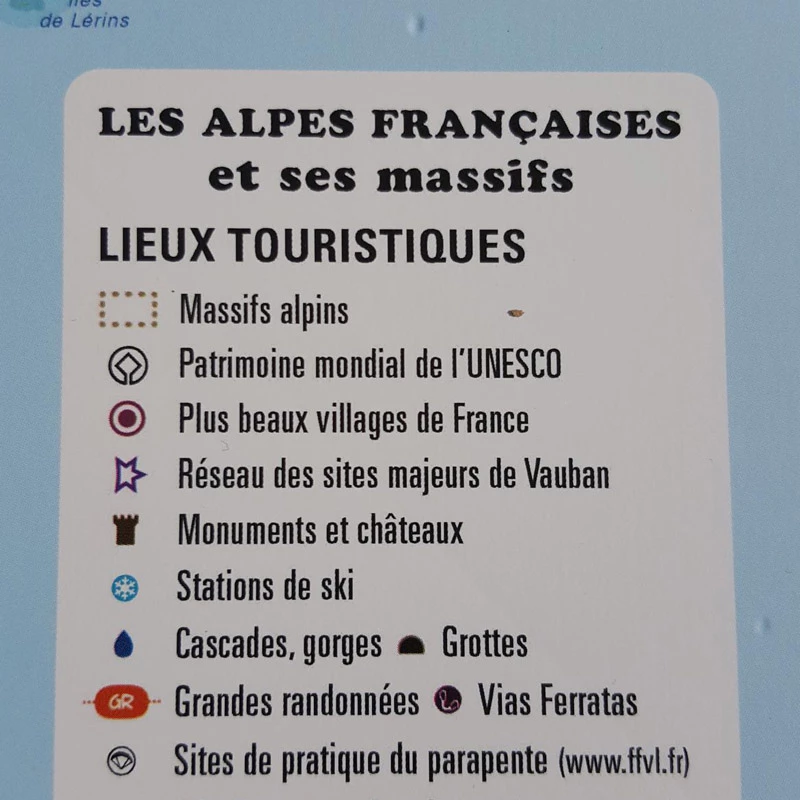
  • Alpine Massifs
  • UNESCO World Heritage sites
  • France's most beautiful villages
  • Network of major Vauban sites
  • Monuments and castles
  • Ski resorts
  • Waterfalls, gorges
  • Caves
  • Hiking trails, Via Ferrata
  • Paragliding sites
  • Take-offs - Landings

100% FRENCH MANUFACTURING :


3DMap has invested a great deal of R&D effort in producing these high quality relief maps. They offer a visual rendering far superior to previous maps in the range, and remain French-designed.

What's more, 3D processing software has been specifically developed to enable wider use of geographic information, such as bathymetric data.

To set off your map to best advantage, use one of the matching frames available in 4 colors.

Air et Aventure also offers a wide range of other 3D maps from 3DMap. Don't hesitate to discover them!
Zoom sur la carte en relief des Alpes Françaises et massifs alpins

Read moreShow less
Product Details
2989

Data sheet

Type of map
Map
TYPE OF PRODUCTS
RELIEF MAP
BF Types
Relief maps
Customers who bought this product also bought:
€42.00 (tax incl.)
The handle for acro This pair of brake handles is ideal for all acro enthusiasts. Weight (g): 100 (Pair) Length (cm ) : 24
Out of stock
€399.00 (tax incl.)
An Alti-Vario GPS for cross-country and competition use Complete, lightweight, high-performance and practical, the SYS'Nav V3 is an alti-vario-GPS with G-meter. The SYS'Nav V3 has proven itself over the years to be...
In stock, immediate delivery!
€35.90 (tax incl.)
A frame to enhance your relief map This stylish wooden frame is ideal for 3DMap embossed maps. Color: White / Black / Wood / Ash Dimensions (cm): 43 x 63 Width (mm) : 15 Thickness (mm) : 30
In stock, immediate delivery!
Related products
€35.90 (tax incl.)
A frame to enhance your relief map This stylish wooden frame is ideal for 3DMap embossed maps. Color: White / Black / Wood / Ash Dimensions (cm): 43 x 63 Width (mm) : 15 Thickness (mm) : 30
In stock, immediate delivery!
€24.00 (tax incl.)
Vol-rando in France: topo-guide to the most beautiful flights Discover the most beautiful vol-randos in France. From the Corsican coast to the magnificent mountain pastures of Haute-Savoie, via the dormant volcanoes...
In stock, immediate delivery!
€28.00 (tax incl.)
Cold doesn't have to get in the way of great adventures Wherever you go, the new Niviuk bonnet is ideal for protecting you from low temperatures.Technical Details Materials: 100% acrylicColors: Reversible : dark gray...
On order
€19.90 (tax incl.)
Relief map for recreational and educational use Discover this mini relief map of Lake Annecy. A famous lake in the French Hautes-Alpes region, Lake Annecy is world-famous. Its location and scenery make it a must for...
On order

Settings

Menu