Click for more products.
No produts were found.
Click for more products.
No produts were found.
Welcome

3DMap Haute-Savoie Relief Map

Relief map for recreational and educational use

Discover the Haute-Savoie department as you've never seen it before with this 3DMap relief map. It's uniquely accurate, so you'll easily find the region's mountain ranges and important paragliding take-off and landing points, as well as lots of other useful information.

Dimensions (cm) : 41 x 61

Scale : 1/230,000

Possibility of adding a frame

Read moreShow less
€39.90 (tax incl.)
In stock, immediate delivery!
Close
Reference:
2995
Description

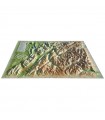
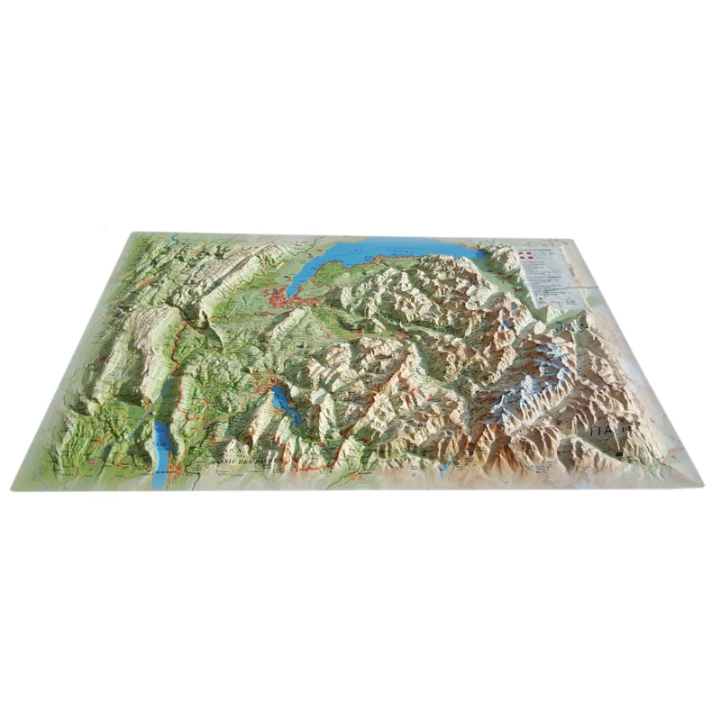
DISCOVER HAUTE-SAVOIE WITH THE 3D MAP

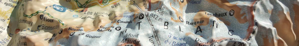
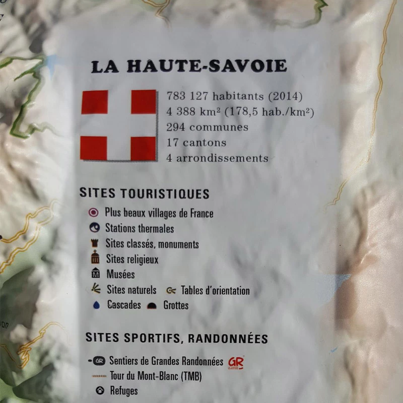
The 3DMap relief map of Haute-Savoie shows you the most beautiful places in the region. From Lac Léman to Lac d'Annecy, via the Haut-Jura massif, the peaks of the Bauges massif and the roof of Europe, Mont-Blanc, this map will meet all your expectations. You'll find, for example, paragliding sites and airfields in Haute-Savoie, natural sites, mountain refuges, and lots of other useful information:

  • Ski resorts
  • Glaciers and peaks
  • Spa resorts
  • Natural sites
  • France's most beautiful villages
  • Refuges
  • Observatories
  • Museums
  • Golf courses
  • Beaches
  • Airfields
  • Monuments and castles of legend
  • Religious sites
  • Hiking trails
  • Trails
  • White water activities
  • Remarkable itineraries
  • The network of Vauban sites
  • Orienteering tables
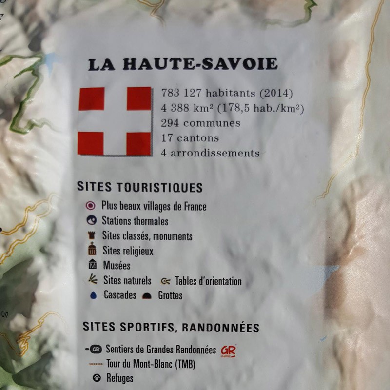
  • Hydrological, natural and hypsometric data
  • Administrative data
  • via Ferrata sites

100% MADE IN FRANCE:

3DMap brand maps have revolutionized the 3D map market. They are the fruit of major R&D efforts, and offer incomparable quality.

For a better presentation, we recommend that you complete your relief map with a frame (available in 4 colors).

Air et Aventure also offers a wide range of other 3DMap relief maps. Don't hesitate to discover them!
Zoom sur la carte en relief de la Haute-Savoie


Read moreShow less
Product Details
2995

Data sheet

Type of map
Map
BF Types
Relief maps
Customers who bought this product also bought:
€35.90 (tax incl.)
A frame to enhance your relief map This stylish wooden frame is ideal for 3DMap embossed maps. Color: White / Black / Wood / Ash Dimensions (cm): 43 x 63 Width (mm) : 15 Thickness (mm) : 30
In stock, immediate delivery!
€39.90 (tax incl.)
Relief map for recreational and educational use Fly over Savoie with this 3DMap relief map. Made 100% in France, it's perfectly accurate. You'll easily find what you're looking for, thanks to the wealth of...
In stock, immediate delivery!
Related products
€35.90 (tax incl.)
A frame to enhance your relief map This stylish wooden frame is ideal for 3DMap embossed maps. Color: White / Black / Wood / Ash Dimensions (cm): 43 x 63 Width (mm) : 15 Thickness (mm) : 30
In stock, immediate delivery!
€24.00 (tax incl.)
Vol-rando in France: topo-guide to the most beautiful flights Discover the most beautiful vol-randos in France. From the Corsican coast to the magnificent mountain pastures of Haute-Savoie, via the dormant volcanoes...
In stock, immediate delivery!
€19.90 (tax incl.)
Relief map for recreational and educational use Discover this mini relief map of the Mont Blanc tour. Centered on Europe's most famous peak, this uncommonly accurate map will give you a whole new perspective on the...
In stock, immediate delivery!
€19.90 (tax incl.)
Relief map for recreational and educational use Discover this mini relief map of Lake Annecy. A famous lake in the French Hautes-Alpes region, Lake Annecy is world-famous. Its location and scenery make it a must for...
On order

Settings

Menu