Relief map for recreational and educational use
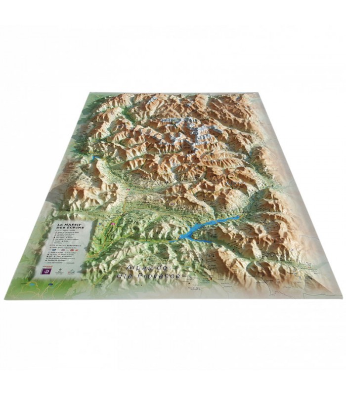
Discover the sumptuous Ecrins massif in a whole new way with this 3DMap relief map. This uniquely precise map shows the region's massifs, important paragliding take-off and landing points, and a wealth of other useful information.
Dimensions (cm) : 41 x 61
Scale : 1/175,000
Possibility of adding a frame
A highly accurate relief map
The relief map of the Ecrins massif shows you one of the most beautiful places in the Hautes-Alpes. In the center, you'll find the Ecrins National Park and its many lakes. This comprehensive map will help you find your way. You'll find paragliding sites, airfields, museums, golf courses, trails and lots of other useful information:
- Ski resorts
- Glaciers and peaks
- Spa resorts
- Natural sites
- France's most beautiful villages
- Refuges
- Observatories
- Beaches
- Airfields
- Monuments and castles of legend
- Religious sites
- Hiking trails
- Huts
- White water activities
- Remarkable itineraries
- The network of Vauban sites
- Orientation tables
- Hydrological, natural and hypsometric data
- Administrative data
- via Ferrata sites
Exceptional French quality:
3DMap brand maps have revolutionized the 3D map market. The result of extensive R&D efforts, they offer unrivalled quality. What's more, they're made entirely in France.
What's more, 3D processing software has been specifically designed to make wide-ranging use of geographic information, such as bathymetric data.
Tips from the Air et Aventure team:
For a better presentation, we suggest you complement your relief map with a frame (available in 4 colors) that you can easily hang on the wall, for example.
Available in 4 versions:
- Card only
- Card + frame (choice of White Oak or Black colors, to be ordered separately)


