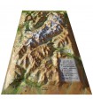
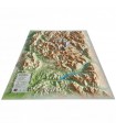
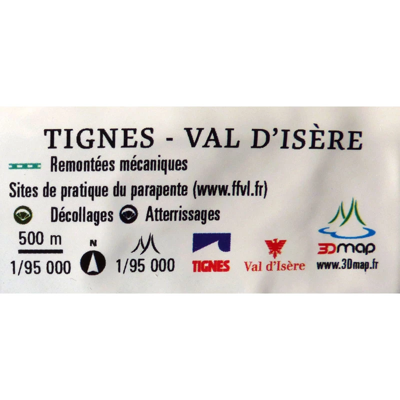
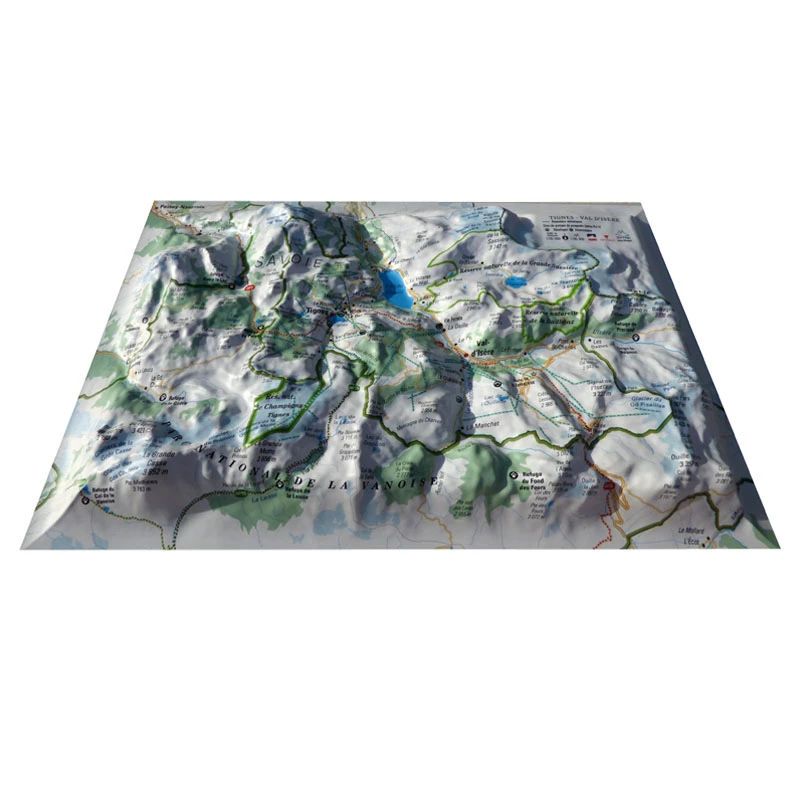
Click for more products.
No produts were found.
Click for more products.
No produts were found.
Welcome

Mini 3D map of Tignes Val d'Isère 3DMap

Relief map for recreational and educational use

Discover this mini relief map of Tignes Val d'Isère. Focusing on the town of Tignes in Savoie, this uncommonly accurate map features the region's glaciers, peaks and lakes, plus lots of other useful information.

Dimensions (cm) : 20 x 30

Planimetric scale : 1/95,000

Altimetric scale: 1/95,000

Read moreShow less
€19.90 (tax incl.)
On order
Close
Reference:
4006
Description

A worked relief map

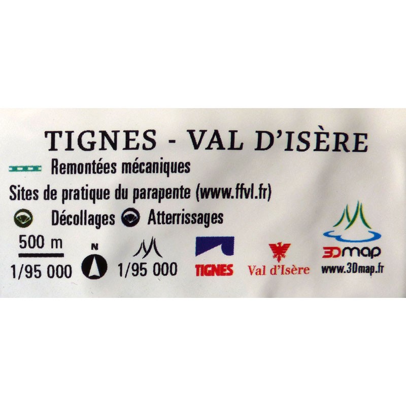
This mini relief map of Tignes Val d'Isère features the region's most beautiful spots. Massifs, glaciers, peaks and the region's many lakes are easily identifiable thanks to the 3DMap's intricate relief work. It also provides a wealth of other useful information, such as sports and hiking sites:

  • Long-distance hiking trails
  • Belvederes, orientation tables
  • Refuge
  • Alpina ski resorts
  • Paragliding sites (www.ffvl.fr)
  • Take-offs, Landings
  • Airports, Aerodromes

An ideal, innovative format for this mini map

The mini relief map of Tignes Val d'Isère is compact enough to carry with you. In fact, you can easily slip it into your rucksack when hiking or walking.

What's more, 3DMap brand maps are made entirely in France, the fruit of extensive R&D efforts. They offer exceptional quality, breaking away from the old relief maps.

What's more, 3D processing software has been specifically developed to enable wider use of geographic information, such as bathymetric data.

Air et Aventure also offers a wide range of other 3D maps from 3DMap. Don't hesitate to discover them!

Zoom sur la mini carte en relief de Tignes Val d'Isère


Read moreShow less
Product Details
4006

Data sheet

Type of map
Mini map
TYPE OF PRODUCTS
RELIEF MAP
BF Types
Relief maps
Related products
€24.00 (tax incl.)
Vol-rando in France: topo-guide to the most beautiful flights Discover the most beautiful vol-randos in France. From the Corsican coast to the magnificent mountain pastures of Haute-Savoie, via the dormant volcanoes...
In stock, immediate delivery!
€39.81 (tax incl.)
The Flying Man's Guide to the Air! 5th Edition out September 2019. More "real intelligence" for a practical weather culture Author : Hubert Aupetit Publication date: 2019 Language : French
In stock, immediate delivery!
€32.00 (tax incl.)
This cap is designed by NEO. It features a large visor at the front and side vents. Size: one size fits allColor: BlackWeight (g): 70 g
Out of stock
€39.90 (tax incl.)
Map of France's most beautiful mountains This relief map features the Hautes Alpes region. Thanks to the quality of its design, you'll be able to easily locate the region's mountains and the ideal places to take off...
In stock, immediate delivery!

Settings

Menu