Click for more products.
No produts were found.
Click for more products.
No produts were found.
Welcome

Hautes Alpes 3D Relief Map

Map of France's most beautiful mountains

This relief map features the Hautes Alpes region. Thanks to the quality of its design, you'll be able to easily locate the region's mountains and the ideal places to take off or land a paraglider, as well as a host of other useful information.

Dimensions (cm) : 41 x 61

Scale : 1/290 000

Possibility of adding a frame

Read moreShow less
€39.90 (tax incl.)
In stock, immediate delivery!
Close
Reference:
4051
Description

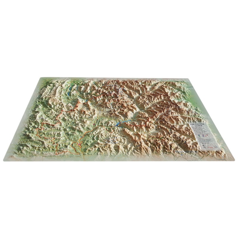
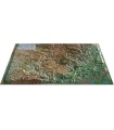
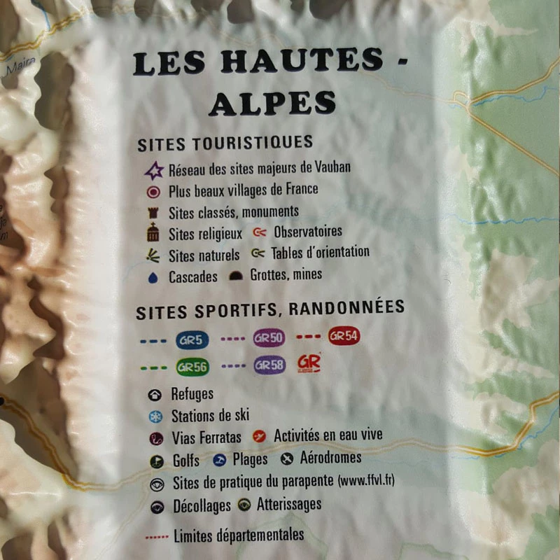
Survey France's highest peaks from the comfort of your home with the Hautes Alpes relief map

Decorate your living room with 3D Map's relief map of the Hautes Alpes. From the Massif des Ecrins to the Queyras Regional Park, discover the sumptuous mountains and valleys between the Drôme and the Italian border. See paragliding sites, ski resorts, Via Ferrata sites and much more:

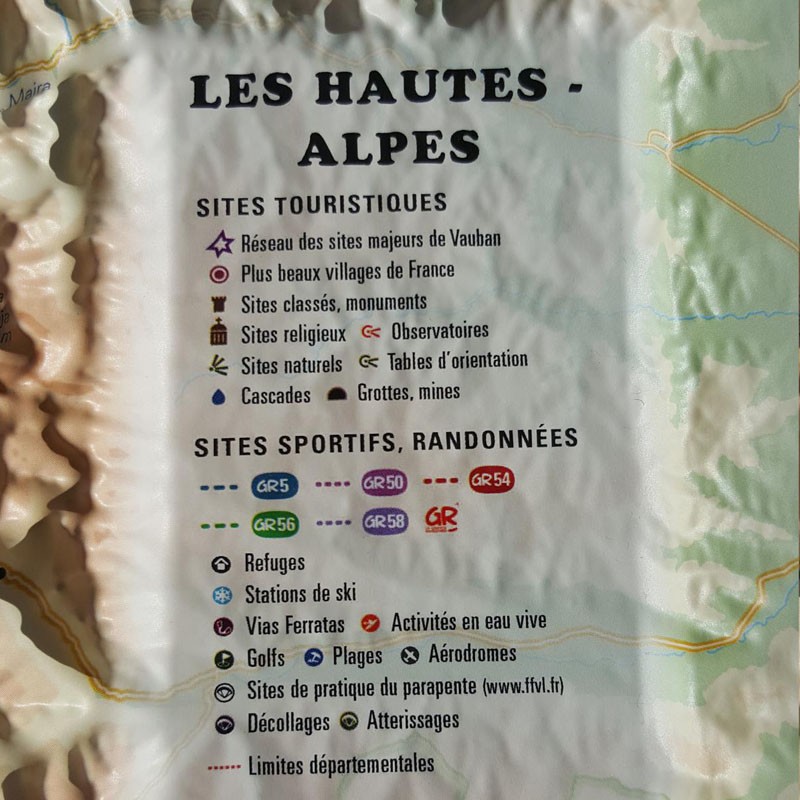
  • Hydrological, natural and hypsometric data
  • Administrative data
  • Museums
  • France's most beautiful villages
  • Golf courses
  • Beaches
  • Airfields
  • Monuments and castles of legend
  • Religious sites
  • Alpine and Nordic ski resorts
  • gliding sites
  • Spa resorts
  • Waterfalls, gorges and caves
  • Glaciers and peaks
  • Alpine massifs
  • Natural sites
  • GR trails
  • Trails
  • Via Ferrata sites
  • White water activities
  • Remarkable itineraries
  • Refuges
  • The network of Vauban sites
  • Observatories
  • Orientation tables

100% FRENCH MANUFACTURE:

3DMap brand maps offer printing quality far superior to that of older relief maps. This is the fruit of major R&D efforts and French design.

In addition, 3D processing software has been specifically developed to enable wider use of geographic information, such as bathymetric data.

For a better presentation, complete your relief map with a suitable frame (available in 4 colors).

Available in 4 versions:

  • Map only
  • Map + frame (choice of White Oak or Black colors, to be ordered separately)

Please note thatAir et Aventure also offers many other 3DMap relief maps. Don't hesitate to discover them!

Read moreShow less
Product Details
4051

Data sheet

Type of map
Map
BF Types
Relief maps
Customers who bought this product also bought:
€39.90 (tax incl.)
Map of the Alpes Provençales This relief map features the Alpes de Haute Provence. Thanks to the quality of its design, you'll be able to easily locate the region's mountains and the ideal places to take off or land a...
In stock, immediate delivery!
Related products
€35.90 (tax incl.)
A frame to enhance your relief map This stylish wooden frame is ideal for 3DMap embossed maps. Color: White / Black / Wood / Ash Dimensions (cm): 43 x 63 Width (mm) : 15 Thickness (mm) : 30
In stock, immediate delivery!
€24.00 (tax incl.)
Vol-rando in France: topo-guide to the most beautiful flights Discover the most beautiful vol-randos in France. From the Corsican coast to the magnificent mountain pastures of Haute-Savoie, via the dormant volcanoes...
In stock, immediate delivery!
€32.00 (tax incl.)
This cap is designed by NEO. It features a large visor at the front and side vents. Size: one size fits allColor: BlackWeight (g): 70 g
Out of stock
€28.00 (tax incl.)
Cold doesn't have to get in the way of great adventures Wherever you go, the new Niviuk bonnet is ideal for protecting you from low temperatures.Technical Details Materials: 100% acrylicColors: Reversible : dark gray...
On order

Settings

Menu